News
All Local News
Search
Last 36 hours
Nation + World
Politics
Justice
Polygamy
Healthcare
Education
Weather
Utah's Right
Elevate
Empower Utah
Legal Notices
Sports
Utah Jazz
RSL
Utah Utes
BYU Cougars
USU Aggies
WSU Wildcats
Preps
Grizzlies
Bees
Outdoors
Winter Sports
Scoreboard
College
Monson
Kragthorpe
All-time BYU football stats
All-time Utes football stats
Blogs
The Utah Effect
Politics
UPIN
The Cricket
TV
Jazz Notes
U of U Sports
BYU Sports
Prep Sports
RSL
Hiking
Outdoors & Travel
More Blogs
Opinion
Editorials
Commentary
Letters
Bagley Cartoon
Rolly
Cannon
Kirby
Blog: State of the Debate
Submit a Letter
Faith
Religion news
LDS Church
Faith Blog
Entertainment
Calendar
Film-Finder
Movies
Restaurants
Lifestyle
Arts
Food
Music
TV
Shopping
Puzzles & Games
Comics
Horoscopes
Cool Stuff
The Legacy of Joe Hill
I Love videos
Whatever Happened To...
Special Reports
TribTalk
Videos
Photo Galleries
Utah Bucket List
Mormon Rivals
Preparing to play
Paul Rolly Roast
Money
Top Workplaces
The Realty Show
Home Prices
Obituaries
Jobs
Find A Job
Post Resume
Featured Employers
Top Jobs
Employment News
Employer Section
POST A JOB
Homes
Find a Home
Find a Realtor
Rentals
Cars
Find a car
Browse
Dealers
Fuel Stop
Elevate
Sponsored articles
Subscribe
Print
New Subscription
Register for e-Edition
Access your e-Edition
Print Registration
Print Login
sltrib.com Membership
Become a Supporting Member
Membership Login
Member FAQ
Premium Ad-Free Site
Toggle navigation
News
All Local News
Search
Last 36 hours
Nation + World
Politics
Justice
Polygamy
Healthcare
Education
Weather
Utah's Right
Elevate
Empower Utah
Legal Notices
Sports
Utah Jazz
RSL
Utah Utes
BYU Cougars
USU Aggies
WSU Wildcats
Preps
Grizzlies
Bees
Outdoors
Winter Sports
Scoreboard
College
Monson
Kragthorpe
All-time BYU football stats
All-time Utes football stats
Blogs
The Utah Effect
Politics
UPIN
The Cricket
TV
Jazz Notes
U of U Sports
BYU Sports
Prep Sports
RSL
Hiking
Outdoors & Travel
More Blogs
Opinion
Editorials
Commentary
Letters
Bagley Cartoon
Rolly
Cannon
Kirby
Blog: State of the Debate
Submit a Letter
Faith
Religion news
LDS Church
Faith Blog
Entertainment
Calendar
Film-Finder
Movies
Restaurants
Lifestyle
Arts
Food
Music
TV
Shopping
Puzzles & Games
Comics
Horoscopes
Cool Stuff
The Legacy of Joe Hill
I Love videos
Whatever Happened To...
Special Reports
TribTalk
Videos
Photo Galleries
Utah Bucket List
Mormon Rivals
Preparing to play
Paul Rolly Roast
Money
Top Workplaces
The Realty Show
Home Prices
Obituaries
Jobs
Find A Job
Post Resume
Featured Employers
Top Jobs
Employment News
Employer Section
POST A JOB
Homes
Find a Home
Find a Realtor
Rentals
Cars
Find a car
Browse
Dealers
Fuel Stop
Subscribe
Print
New Subscription
Register for e-Edition
Access your e-Edition
Print Registration
Print Login
sltrib.com Membership
Become a Supporting Member
Membership Login
Member FAQ
Premium Ad-Free Site
Home
Salt Lake City °
Traffic
WWW.SLTRIB.COM
Become a Member
|
Ad-Free Login
Home
Weather
|
Traffic
Become a Member
|
Ad-Free Login
Home
Become a Member
|
Ad-Free Login
Hikes Index
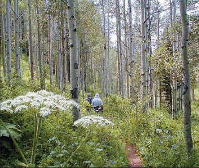
Butler Fork Trail - Big Cottonwood Canyon
Hikers enjoy the varied terrain along the looping trail.